Loading map...
{"minzoom":false,"maxzoom":false,"mappingservice":"leaflet","width":"auto","height":"600px","centre":{"text":"","title":"","link":"","lat":50.6497,"lon":-2.0933,"icon":""},"title":"","label":"","icon":"","lines":[],"polygons":[],"circles":[],"rectangles":[],"copycoords":false,"static":false,"zoom":false,"defzoom":14,"layers":["OpenStreetMap","Esri.WorldImagery"],"image layers":[],"overlays":[],"resizable":false,"fullscreen":true,"scrollwheelzoom":true,"cluster":false,"clustermaxzoom":20,"clusterzoomonclick":true,"clustermaxradius":1,"clusterspiderfy":true,"geojson":"","clicktarget":"","imageLayers":[],"locations":[{"text":"\u003Cb\u003E\u003Cdiv class=\"mw-parser-output\"\u003E\u003Cp\u003E\u003Ca href=\"/Q124945092\" title=\"Q124945092\"\u003EChristchurch Hampshire County Council and County Borough of Bournemouth Area Control\u003C/a\u003E\u003C/b\u003E\u003Cdiv class=\"mw-parser-output\"\u003E\u003Cp\u003Ecivil defense center\n\u003C/p\u003E\u003C/div\u003E","title":"Christchurch Hampshire County Council and County Borough of Bournemouth Area Control@ civil defense center\n","link":"","lat":50.737508,"lon":-1.755414,"icon":"/images/6/6e/M_bunker.png"},{"text":"\u003Cb\u003E\u003Cdiv class=\"mw-parser-output\"\u003E\u003Cp\u003E\u003Ca href=\"/Q5471318\" title=\"Q5471318\"\u003EFort Henry\u003C/a\u003E\u003C/b\u003E\u003Cdiv class=\"mw-parser-output\"\u003E\u003Cp\u003Ebunker\n\u003C/p\u003E\u003C/div\u003E","title":"Fort Henry@ bunker\n","link":"","lat":50.6452,"lon":-1.94785,"icon":"/images/6/6e/M_bunker.png"},{"text":"\u003Cb\u003E\u003Cdiv class=\"mw-parser-output\"\u003E\u003Cp\u003E\u003Ca href=\"/Q124823217\" title=\"Q124823217\"\u003ERidgeway Hill Anti-Aircraft Operations Room\u003C/a\u003E\u003C/b\u003E\u003Cdiv class=\"mw-parser-output\"\u003E\u003Cp\u003Ebunker\n\u003C/p\u003E\u003C/div\u003E","title":"Ridgeway Hill Anti-Aircraft Operations Room@ bunker\n","link":"","lat":50.670252,"lon":-2.456167,"icon":"/images/6/6e/M_bunker.png"},{"text":"\u003Cb\u003E\u003Cdiv class=\"mw-parser-output\"\u003E\u003Cp\u003E\u003Ca href=\"/Q17537918\" title=\"Q17537918\"\u003EGrotto 250 Metres South East Of St Giles House\u003C/a\u003E\u003C/b\u003E\u003Cdiv class=\"mw-parser-output\"\u003E\u003Cp\u003Egrotto\n\u003C/p\u003E\u003C/div\u003E","title":"Grotto 250 Metres South East Of St Giles House@ grotto\n","link":"","lat":50.9023,"lon":-1.95234,"icon":"/images/4/48/M_cave.png"},{"text":"\u003Cb\u003E\u003Cdiv class=\"mw-parser-output\"\u003E\u003Cp\u003E\u003Ca href=\"/Q26524161\" title=\"Q26524161\"\u003EGrotto In Grounds Of Rempstone Hall, 90 Metres North North East Of Rempstone Hall\u003C/a\u003E\u003C/b\u003E\u003Cdiv class=\"mw-parser-output\"\u003E\u003Cp\u003Egrotto\n\u003C/p\u003E\u003C/div\u003E","title":"Grotto In Grounds Of Rempstone Hall, 90 Metres North North East Of Rempstone Hall@ grotto\n","link":"","lat":50.642344,"lon":-2.012944,"icon":"/images/4/48/M_cave.png"},{"text":"\u003Cb\u003E\u003Cdiv class=\"mw-parser-output\"\u003E\u003Cp\u003E\u003Ca href=\"/Q26609204\" title=\"Q26609204\"\u003EGrotto Or Rock Bridge, 400 Metres South South East Of Encombe House\u003C/a\u003E\u003C/b\u003E\u003Cdiv class=\"mw-parser-output\"\u003E\u003Cp\u003Egrotto\n\u003C/p\u003E\u003C/div\u003E","title":"Grotto Or Rock Bridge, 400 Metres South South East Of Encombe House@ grotto\n","link":"","lat":50.603074,"lon":-2.0784,"icon":"/images/4/48/M_cave.png"},{"text":"\u003Cb\u003E\u003Cdiv class=\"mw-parser-output\"\u003E\u003Cp\u003E\u003Ca href=\"/Q1773783\" title=\"Q1773783\"\u003ETilly Whim Caves\u003C/a\u003E\u003C/b\u003E\u003Cdiv class=\"mw-parser-output\"\u003E\u003Cp\u003Ecave\n\u003C/p\u003E\u003C/div\u003E","title":"Tilly Whim Caves@ cave\n","link":"","lat":50.5925,"lon":-1.95752,"icon":"/images/4/48/M_cave.png"},{"text":"\u003Cb\u003E\u003Cdiv class=\"mw-parser-output\"\u003E\u003Cp\u003E\u003Ca href=\"/Q815869\" title=\"Q815869\"\u003EBelle Vue Quarry\u003C/a\u003E\u003C/b\u003E\u003Cdiv class=\"mw-parser-output\"\u003E\u003Cp\u003Equarry\n\u003C/p\u003E\u003C/div\u003E","title":"Belle Vue Quarry@ quarry\n","link":"","lat":50.6035,"lon":-1.98158,"icon":"/images/a/ab/M_mine.png"},{"text":"\u003Cb\u003E\u003Cdiv class=\"mw-parser-output\"\u003E\u003Cp\u003E\u003Ca class=\"mw-selflink selflink\"\u003EBlue Pool\u003C/a\u003E\u003C/b\u003E\u003Cdiv class=\"mw-parser-output\"\u003E\u003Cp\u003Echalk quarry, lake\n\u003C/p\u003E\u003C/div\u003E","title":"Blue Pool@ chalk quarry, lake\n","link":"","lat":50.6497,"lon":-2.0933,"icon":"/images/d/d2/Red-marker.png"},{"text":"\u003Cb\u003E\u003Cdiv class=\"mw-parser-output\"\u003E\u003Cp\u003E\u003Ca href=\"/Q18359204\" title=\"Q18359204\"\u003EBowers Quarry\u003C/a\u003E\u003C/b\u003E\u003Cdiv class=\"mw-parser-output\"\u003E\u003Cp\u003Equarry\n\u003C/p\u003E\u003C/div\u003E","title":"Bowers Quarry@ quarry\n","link":"","lat":50.5462,"lon":-2.4482,"icon":"/images/a/ab/M_mine.png"},{"text":"\u003Cb\u003E\u003Cdiv class=\"mw-parser-output\"\u003E\u003Cp\u003E\u003Ca href=\"/Q15204939\" title=\"Q15204939\"\u003EBroadcroft Quarry\u003C/a\u003E\u003C/b\u003E\u003Cdiv class=\"mw-parser-output\"\u003E\u003Cp\u003Equarry\n\u003C/p\u003E\u003C/div\u003E","title":"Broadcroft Quarry@ quarry\n","link":"","lat":50.5468,"lon":-2.4288,"icon":"/images/a/ab/M_mine.png"},{"text":"\u003Cb\u003E\u003Cdiv class=\"mw-parser-output\"\u003E\u003Cp\u003E\u003Ca href=\"/Q5068591\" title=\"Q5068591\"\u003EChalbury Hill And Quarry\u003C/a\u003E\u003C/b\u003E\u003Cdiv class=\"mw-parser-output\"\u003E\u003Cp\u003Equarry\n\u003C/p\u003E\u003C/div\u003E","title":"Chalbury Hill And Quarry@ quarry\n","link":"","lat":50.653069444,"lon":-2.434219444,"icon":"/images/a/ab/M_mine.png"},{"text":"\u003Cb\u003E\u003Cdiv class=\"mw-parser-output\"\u003E\u003Cp\u003E\u003Ca href=\"/Q18348893\" title=\"Q18348893\"\u003ECoombefield Quarry\u003C/a\u003E\u003C/b\u003E\u003Cdiv class=\"mw-parser-output\"\u003E\u003Cp\u003Equarry\n\u003C/p\u003E\u003C/div\u003E","title":"Coombefield Quarry@ quarry\n","link":"","lat":50.534,"lon":-2.4382,"icon":"/images/a/ab/M_mine.png"},{"text":"\u003Cb\u003E\u003Cdiv class=\"mw-parser-output\"\u003E\u003Cp\u003E\u003Ca href=\"/Q24896047\" title=\"Q24896047\"\u003EJordans Mine\u003C/a\u003E\u003C/b\u003E\u003Cdiv class=\"mw-parser-output\"\u003E\u003Cp\u003Equarry\n\u003C/p\u003E\u003C/div\u003E","title":"Jordans Mine@ quarry\n","link":"","lat":50.547937,"lon":-2.441088,"icon":"/images/a/ab/M_mine.png"},{"text":"\u003Cb\u003E\u003Cdiv class=\"mw-parser-output\"\u003E\u003Cp\u003E\u003Ca href=\"/Q6411265\" title=\"Q6411265\"\u003EKing Barrow Quarry\u003C/a\u003E\u003C/b\u003E\u003Cdiv class=\"mw-parser-output\"\u003E\u003Cp\u003Equarry\n\u003C/p\u003E\u003C/div\u003E","title":"King Barrow Quarry@ quarry\n","link":"","lat":50.5552,"lon":-2.436,"icon":"/images/a/ab/M_mine.png"},{"text":"\u003Cb\u003E\u003Cdiv class=\"mw-parser-output\"\u003E\u003Cp\u003E\u003Ca href=\"/Q18387763\" title=\"Q18387763\"\u003EPerryfield Quarry\u003C/a\u003E\u003C/b\u003E\u003Cdiv class=\"mw-parser-output\"\u003E\u003Cp\u003Equarry\n\u003C/p\u003E\u003C/div\u003E","title":"Perryfield Quarry@ quarry\n","link":"","lat":50.5389,"lon":-2.4338,"icon":"/images/a/ab/M_mine.png"},{"text":"\u003Cb\u003E\u003Cdiv class=\"mw-parser-output\"\u003E\u003Cp\u003E\u003Ca href=\"/Q7496675\" title=\"Q7496675\"\u003EShillingstone Quarry\u003C/a\u003E\u003C/b\u003E\u003Cdiv class=\"mw-parser-output\"\u003E\u003Cp\u003ESite of Special Scientific Interest, quarry\n\u003C/p\u003E\u003C/div\u003E","title":"Shillingstone Quarry@ Site of Special Scientific Interest, quarry\n","link":"","lat":50.8874,"lon":-2.253,"icon":"/images/a/ab/M_mine.png"},{"text":"\u003Cb\u003E\u003Cdiv class=\"mw-parser-output\"\u003E\u003Cp\u003E\u003Ca href=\"/Q7829416\" title=\"Q7829416\"\u003ETout Quarry\u003C/a\u003E\u003C/b\u003E\u003Cdiv class=\"mw-parser-output\"\u003E\u003Cp\u003Esculpture garden, quarry\n\u003C/p\u003E\u003C/div\u003E","title":"Tout Quarry@ sculpture garden, quarry\n","link":"","lat":50.5531,"lon":-2.4446,"icon":"/images/a/ab/M_mine.png"},{"text":"\u003Cb\u003E\u003Cdiv class=\"mw-parser-output\"\u003E\u003Cp\u003E\u003Ca href=\"/Q2584848\" title=\"Q2584848\"\u003EWinspit\u003C/a\u003E\u003C/b\u003E\u003Cdiv class=\"mw-parser-output\"\u003E\u003Cp\u003Equarry\n\u003C/p\u003E\u003C/div\u003E","title":"Winspit@ quarry\n","link":"","lat":50.5848,"lon":-2.0342,"icon":"/images/a/ab/M_mine.png"},{"text":"\u003Cb\u003E\u003Cdiv class=\"mw-parser-output\"\u003E\u003Cp\u003E\u003Ca href=\"/Q18390307\" title=\"Q18390307\"\u003EYeolands Quarry\u003C/a\u003E\u003C/b\u003E\u003Cdiv class=\"mw-parser-output\"\u003E\u003Cp\u003Equarry\n\u003C/p\u003E\u003C/div\u003E","title":"Yeolands Quarry@ quarry\n","link":"","lat":50.5462,"lon":-2.4239,"icon":"/images/a/ab/M_mine.png"},{"text":"\u003Cb\u003E\u003Cdiv class=\"mw-parser-output\"\u003E\u003Cp\u003E\u003Ca href=\"/Q16898899\" title=\"Q16898899\"\u003EPurbeck Mineral and Mining Museum\u003C/a\u003E\u003C/b\u003E\u003Cdiv class=\"mw-parser-output\"\u003E\u003Cp\u003E2014 mining museum, \u003Ca rel=\"nofollow\" class=\"external text\" href=\"https://www.tripadvisor.com/4459016\"\u003Etripadvisor\u003C/a\u003E\n\u003C/p\u003E\u003C/div\u003E","title":"Purbeck Mineral and Mining Museum@2014 mining museum, tripadvisor\n","link":"","lat":50.645596,"lon":-2.062624,"icon":"/images/f/f6/Tm_museum.png"},{"text":"\u003Cb\u003E\u003Cdiv class=\"mw-parser-output\"\u003E\u003Cp\u003E\u003Ca href=\"/Q116695128\" title=\"Q116695128\"\u003ERodwell Tunnel\u003C/a\u003E\u003C/b\u003E\u003Cdiv class=\"mw-parser-output\"\u003E\u003Cp\u003Erailway tunnel\n\u003C/p\u003E\u003C/div\u003E","title":"Rodwell Tunnel@ railway tunnel\n","link":"","lat":50.6046906,"lon":-2.4622853,"icon":"/images/0/04/M_tunnel.png"}],"imageoverlays":null}
 Blue Pool, Furzebrook, Dorset - geograph.org.uk - 720161 1984
 Blue Pool, Furzebrook, Dorset - geograph.org.uk - 720886 1984
 Blue Pool, Furzebrook - geograph.org.uk - 1504305 2002
 Blue Pool - geograph.org.uk - 348379 2006
 Furzebrook, Blue Pool from above - geograph.org.uk - 823192 2008
 Furzebrook, Blue Pool from the west - geograph.org.uk - 823151 2008
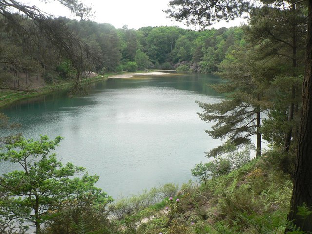 Furzebrook, Blue Pool - geograph.org.uk - 823160 2008
 Furzebrook, Blue Pool through the trees - geograph.org.uk - 823195 2008
 Furzebrook, picnic benches at Blue Pool - geograph.org.uk - 823167 2008
 Furzebrook, the edge of Blue Pool - geograph.org.uk - 823163 2008
 The Blue Pool, Furzebrook - geograph.org.uk - 78921 2000
 The Blue Pool - geograph.org.uk - 1007553 1981