Loading map...
{"minzoom":false,"maxzoom":false,"mappingservice":"leaflet","width":"auto","height":"600px","centre":{"text":"","title":"","link":"","lat":52.820555555,"lon":-4.638888888,"icon":""},"title":"","label":"","icon":"","lines":[],"polygons":[],"circles":[],"rectangles":[],"copycoords":false,"static":false,"zoom":false,"defzoom":14,"layers":["OpenStreetMap","Esri.WorldImagery"],"image layers":[],"overlays":[],"resizable":false,"fullscreen":true,"scrollwheelzoom":true,"cluster":false,"clustermaxzoom":20,"clusterzoomonclick":true,"clustermaxradius":1,"clusterspiderfy":true,"geojson":"","clicktarget":"","imageLayers":[],"locations":[{"text":"\u003Cb\u003E\u003Cdiv class=\"mw-parser-output\"\u003E\u003Cp\u003E\u003Ca href=\"/Q123520917\" title=\"Q123520917\"\u003EYstwffwl Glas\u003C/a\u003E\u003C/b\u003E\u003Cdiv class=\"mw-parser-output\"\u003E\u003Cp\u003Ecave\n\u003C/p\u003E\u003C/div\u003E","title":"Ystwffwl Glas@ cave\n","link":"","lat":52.748678,"lon":-4.8004188,"icon":"/images/4/48/M_cave.png"},{"text":"\u003Cb\u003E\u003Cdiv class=\"mw-parser-output\"\u003E\u003Cp\u003E\u003Ca href=\"/Q102081600\" title=\"Q102081600\"\u003EAshton Lead Mines\u003C/a\u003E\u003C/b\u003E\u003Cdiv class=\"mw-parser-output\"\u003E\u003Cp\u003Elead mine\n\u003C/p\u003E\u003C/div\u003E","title":"Ashton Lead Mines@ lead mine\n","link":"","lat":52.807946,"lon":-4.496841,"icon":"/images/a/ab/M_mine.png"},{"text":"\u003Cb\u003E\u003Cdiv class=\"mw-parser-output\"\u003E\u003Cp\u003E\u003Ca class=\"mw-selflink selflink\"\u003EBenallt mine\u003C/a\u003E\u003C/b\u003E\u003Cdiv class=\"mw-parser-output\"\u003E\u003Cp\u003Emine\n\u003C/p\u003E\u003C/div\u003E","title":"Benallt mine@ mine\n","link":"","lat":52.820555555,"lon":-4.638888888,"icon":"/images/d/d2/Red-marker.png"},{"text":"\u003Cb\u003E\u003Cdiv class=\"mw-parser-output\"\u003E\u003Cp\u003E\u003Ca href=\"/Q88382255\" title=\"Q88382255\"\u003ECarreg-y-Llam quarry\u003C/a\u003E\u003C/b\u003E\u003Cdiv class=\"mw-parser-output\"\u003E\u003Cp\u003Equarry\n\u003C/p\u003E\u003C/div\u003E","title":"Carreg-y-Llam quarry@ quarry\n","link":"","lat":52.965972222,"lon":-4.478638888,"icon":"/images/a/ab/M_mine.png"},{"text":"\u003Cb\u003E\u003Cdiv class=\"mw-parser-output\"\u003E\u003Cp\u003E\u003Ca href=\"/Q88369222\" title=\"Q88369222\"\u003EEifl quarry\u003C/a\u003E\u003C/b\u003E\u003Cdiv class=\"mw-parser-output\"\u003E\u003Cp\u003Equarry\n\u003C/p\u003E\u003C/div\u003E","title":"Eifl quarry@ quarry\n","link":"","lat":52.985972222,"lon":-4.440583333,"icon":"/images/a/ab/M_mine.png"},{"text":"\u003Cb\u003E\u003Cdiv class=\"mw-parser-output\"\u003E\u003Cp\u003E\u003Ca href=\"/Q88374564\" title=\"Q88374564\"\u003EGimlet quarry\u003C/a\u003E\u003C/b\u003E\u003Cdiv class=\"mw-parser-output\"\u003E\u003Cp\u003E1867 quarry\n\u003C/p\u003E\u003C/div\u003E","title":"Gimlet quarry@1867 quarry\n","link":"","lat":52.88175,"lon":-4.399805555,"icon":"/images/a/ab/M_mine.png"},{"text":"\u003Cb\u003E\u003Cdiv class=\"mw-parser-output\"\u003E\u003Cp\u003E\u003Ca href=\"/Q88384066\" title=\"Q88384066\"\u003EGyrn Ddu quarry\u003C/a\u003E\u003C/b\u003E\u003Cdiv class=\"mw-parser-output\"\u003E\u003Cp\u003Equarry\n\u003C/p\u003E\u003C/div\u003E","title":"Gyrn Ddu quarry@ quarry\n","link":"","lat":52.993388888,"lon":-4.394805555,"icon":"/images/a/ab/M_mine.png"},{"text":"\u003Cb\u003E\u003Cdiv class=\"mw-parser-output\"\u003E\u003Cp\u003E\u003Ca href=\"/Q102081607\" title=\"Q102081607\"\u003EPant Gwyn\u003C/a\u003E\u003C/b\u003E\u003Cdiv class=\"mw-parser-output\"\u003E\u003Cp\u003Elead mine\n\u003C/p\u003E\u003C/div\u003E","title":"Pant Gwyn@ lead mine\n","link":"","lat":52.811226,"lon":-4.511868,"icon":"/images/a/ab/M_mine.png"},{"text":"\u003Cb\u003E\u003Cdiv class=\"mw-parser-output\"\u003E\u003Cp\u003E\u003Ca href=\"/Q102082446\" title=\"Q102082446\"\u003EPenrhynmawr Lead Mine\u003C/a\u003E\u003C/b\u003E\u003Cdiv class=\"mw-parser-output\"\u003E\u003Cp\u003Elead mine\n\u003C/p\u003E\u003C/div\u003E","title":"Penrhynmawr Lead Mine@ lead mine\n","link":"","lat":52.807297,"lon":-4.489637,"icon":"/images/a/ab/M_mine.png"},{"text":"\u003Cb\u003E\u003Cdiv class=\"mw-parser-output\"\u003E\u003Cp\u003E\u003Ca href=\"/Q102081659\" title=\"Q102081659\"\u003EPorth-Neigwl Lead Mine\u003C/a\u003E\u003C/b\u003E\u003Cdiv class=\"mw-parser-output\"\u003E\u003Cp\u003Elead mine\n\u003C/p\u003E\u003C/div\u003E","title":"Porth-Neigwl Lead Mine@ lead mine\n","link":"","lat":52.811342,"lon":-4.53176,"icon":"/images/a/ab/M_mine.png"},{"text":"\u003Cb\u003E\u003Cdiv class=\"mw-parser-output\"\u003E\u003Cp\u003E\u003Ca href=\"/Q102081611\" title=\"Q102081611\"\u003ETan Bwlch Lead Mine\u003C/a\u003E\u003C/b\u003E\u003Cdiv class=\"mw-parser-output\"\u003E\u003Cp\u003Elead mine\n\u003C/p\u003E\u003C/div\u003E","title":"Tan Bwlch Lead Mine@ lead mine\n","link":"","lat":52.810453,"lon":-4.505888,"icon":"/images/a/ab/M_mine.png"},{"text":"\u003Cb\u003E\u003Cdiv class=\"mw-parser-output\"\u003E\u003Cp\u003E\u003Ca href=\"/Q124664357\" title=\"Q124664357\"\u003ETyddyn-Du\u003C/a\u003E\u003C/b\u003E\u003Cdiv class=\"mw-parser-output\"\u003E\u003Cp\u003Emanganese mine\n\u003C/p\u003E\u003C/div\u003E","title":"Tyddyn-Du@ manganese mine\n","link":"","lat":53.01201,"lon":-4.34462,"icon":"/images/a/ab/M_mine.png"}],"imageoverlays":null}
 Aberdaron - Nant-y-Gadwen Manganese Mine 2007
 A steam engine which was used to winch wagons up the incline from the opencast workings at Rhiw - geograph.org.uk - 613043 2007
 Bodwyddog Farm - geograph.org.uk - 610500 2007
 Manganese Mine winding gear at Porth Ysgo - geograph.org.uk - 437390 2007
 Miners' path from Benallt Mine to the village of Rhiw - geograph.org.uk - 611429 2007
 Mine winding gear near Porth Ysgo - geograph.org.uk - 1010894 1997
 Ruined engine shed and spoil heaps at Nant y Gadwen - geograph.org.uk - 612399 2007
 The line of the two top inclines of the Benallt Tramway at Nant y Gadwen - geograph.org.uk - 612661 2007
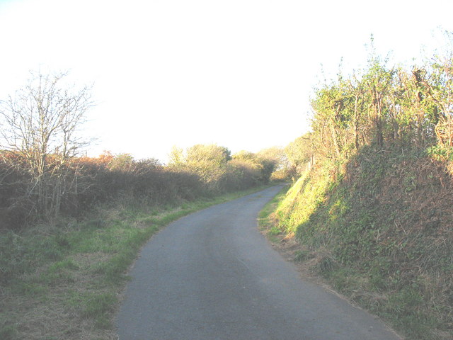 The Nant Road - geograph.org.uk - 611363 2007
 The top Benallt Tramway incline at Nant y Gadwen - geograph.org.uk - 612651 2007
 The trackbed of the former Benallt tramway from the Porth Ysgo Path - geograph.org.uk - 610497 2007
 View east across the Rhiw and Benallt manganese mines - geograph.org.uk - 613015 2007