uranium mine
From Underfoot Expounder
Q28599311
mine which primarily produces ores containing uranium
Wikimedia, Wikidata
- Journal of Environmental Radioactivity Estimation of radon release rate for an underground uranium mine ventilation shaft in China and radon distribution characteristics@
Countries:
{"selectable":false,"width":"1000px","zoomMin":100000000000}
 Colorado Plateau Geologic Cross Section 1856
 Colorado Plateau Map showing distribution of Triassic uranium deposits 1956
 Entrance Sign, Madawaska Mine, circa 1985 1985
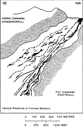 Fay-Ace-Verna Mines geologic cross section 1981
 Gunnar Mine geologic map and cross section 1981
 Madawaska Mine Entrance circa 1985 1985
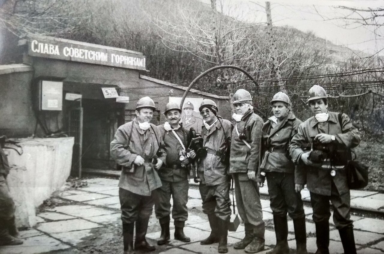 Miners of Uranium mine 2 1979
 Panorama of Mount Beshtau 1964 1964
 USGS geologic map of the Pumpkin Buttes uranium area 1964
 USGS Lisbon Valley map 1966
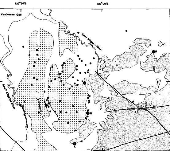 USGS Pine Creek Geosyncline 1985
 USGS Uravan Mineral Belt 1952
| Type | Date | Description | Keywords | Notes | Source |
|---|---|---|---|---|---|
| link | Journal of Environmental Radioactivity Estimation of radon release rate for an underground uranium mine ventilation shaft in China and radon distribution characteristics@ |
| Wikidata | ||
| image | 1856 | Colorado Plateau Geologic Cross Section |
| Wikimedia | |
| image | 1956 | Colorado Plateau Map showing distribution of Triassic uranium deposits |
| Wikimedia | |
| image | 1985 | Entrance Sign, Madawaska Mine, circa 1985 |
| Wikimedia | |
| image | 1981 | Fay-Ace-Verna Mines geologic cross section |
| Wikimedia | |
| image | 1981 | Gunnar Mine geologic map and cross section |
| Wikimedia | |
| image | 1985 | Madawaska Mine Entrance circa 1985 |
| Wikimedia | |
| image | 1979 | Miners of Uranium mine 2 |
| Wikimedia | |
| image | 1964 | Panorama of Mount Beshtau 1964 |
| Wikimedia | |
| image | 1964 | USGS geologic map of the Pumpkin Buttes uranium area |
| Wikimedia | |
| image | 1966 | USGS Lisbon Valley map |
| Wikimedia | |
| image | 1985 | USGS Pine Creek Geosyncline |
| Wikimedia | |
| image | 1952 | USGS Uravan Mineral Belt |
| Wikimedia | |