Transpennine Trail - geograph.org.uk - 1709182.jpg
From Underfoot Expounder
File:Transpennine Trail - geograph.org.uk - 1709182.jpg

Size of this preview: 800 × 599 pixels. Other resolutions: 320 × 240 pixels | 640 × 480 pixels | 1,024 × 767 pixels | 1,280 × 959 pixels.
Original file (1,280 × 959 pixels, file size: 466 KB, MIME type: image/jpeg)
Summary
| Description |
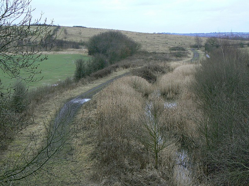
English: Transpennine Trail Following a former railway line near Shaftholme. The raised ground beyond is the former Bentley Colliery spoil tip. |
| Date | |
| Source | From geograph.org.uk |
| Author | Alan Murray-Rust |
| Permission (Reusing this file) |
Creative Commons Attribution Share-alike license 2.0 |
| Attribution (required by the licence) | Alan Murray-Rust / Transpennine Trail / |
| Camera location | | View this and other nearby images on: OpenStreetMap |
|---|
_heading:202.00&language=en-gb)
| Object location | | View this and other nearby images on: OpenStreetMap |
|---|
_heading:202.00&language=en-gb)
Licensing

|
This image was taken from the Geograph GB & Eire project collection. See this photograph's page on the Geograph website for the photographer's contact details. The copyright on this image is owned by Alan Murray-Rust, and is licensed for reuse under the Creative Commons Attribution Share-Alike 2.0 license.
|
This file is licensed under the Creative Commons Attribution-Share Alike 2.0 Generic licence.
Attribution: Alan Murray-Rust
- You are free:
- to share – to copy, distribute and transmit the work
- to remix – to adapt the work
- Under the following conditions:
- attribution – You must give appropriate credit, provide a link to the licence, and indicate if changes were made. You may do so in any reasonable manner, but not in any way that suggests the licensor endorses you or your use.
- share alike – If you remix, transform, or build upon the material, you must distribute your contributions under the same or compatible licence as the original.
File history
Click on a date/time to view the file as it appeared at that time.
| Date/Time | Thumbnail | Dimensions | User | Comment | |
|---|---|---|---|---|---|
| current | 06:31, 5 March 2011 | | 1,280 × 959 (466 KB) | wikimediacommons>GeographBot | == {{int:filedesc}} == {{Information |description={{en|1=Transpennine Trail Following a former railway line near Shaftholme. The raised ground beyond is the former Bentley Colliery spoil tip. }} |date=2010-02-08 |source=From [http://www.geograph.org.uk/p |
File usage
The following page uses this file: